下載 APKPure App
可在安卓獲取CERT Surveyor的歷史版本
社區應急培訓測量員應用
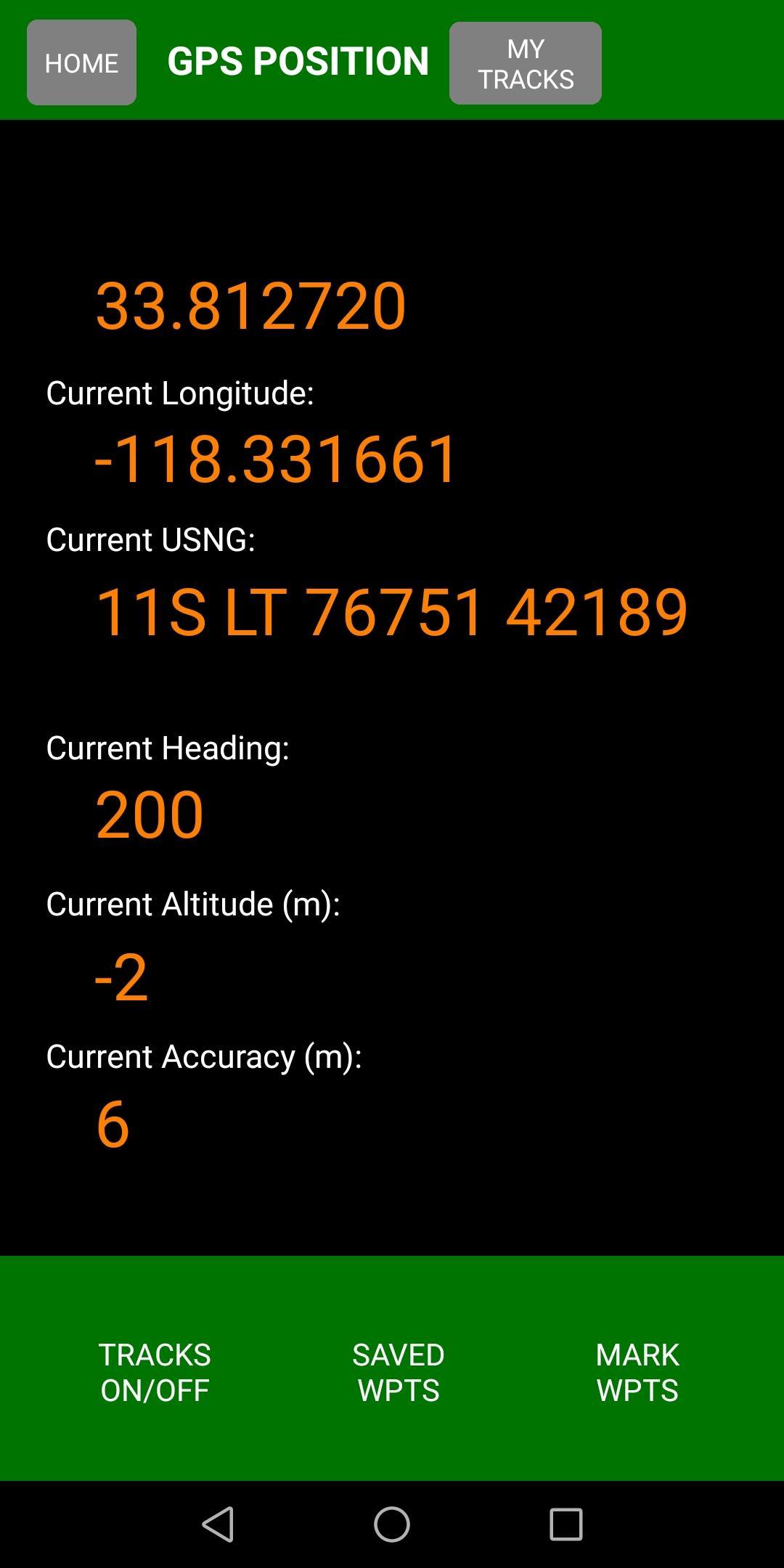
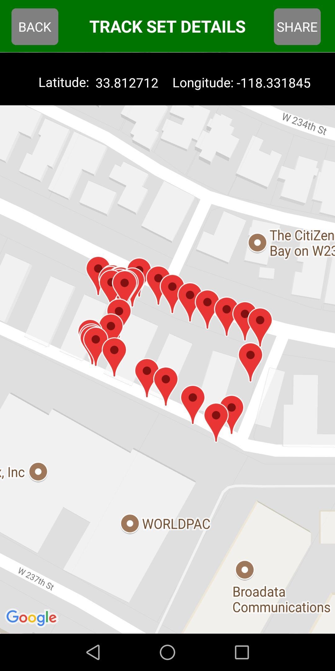
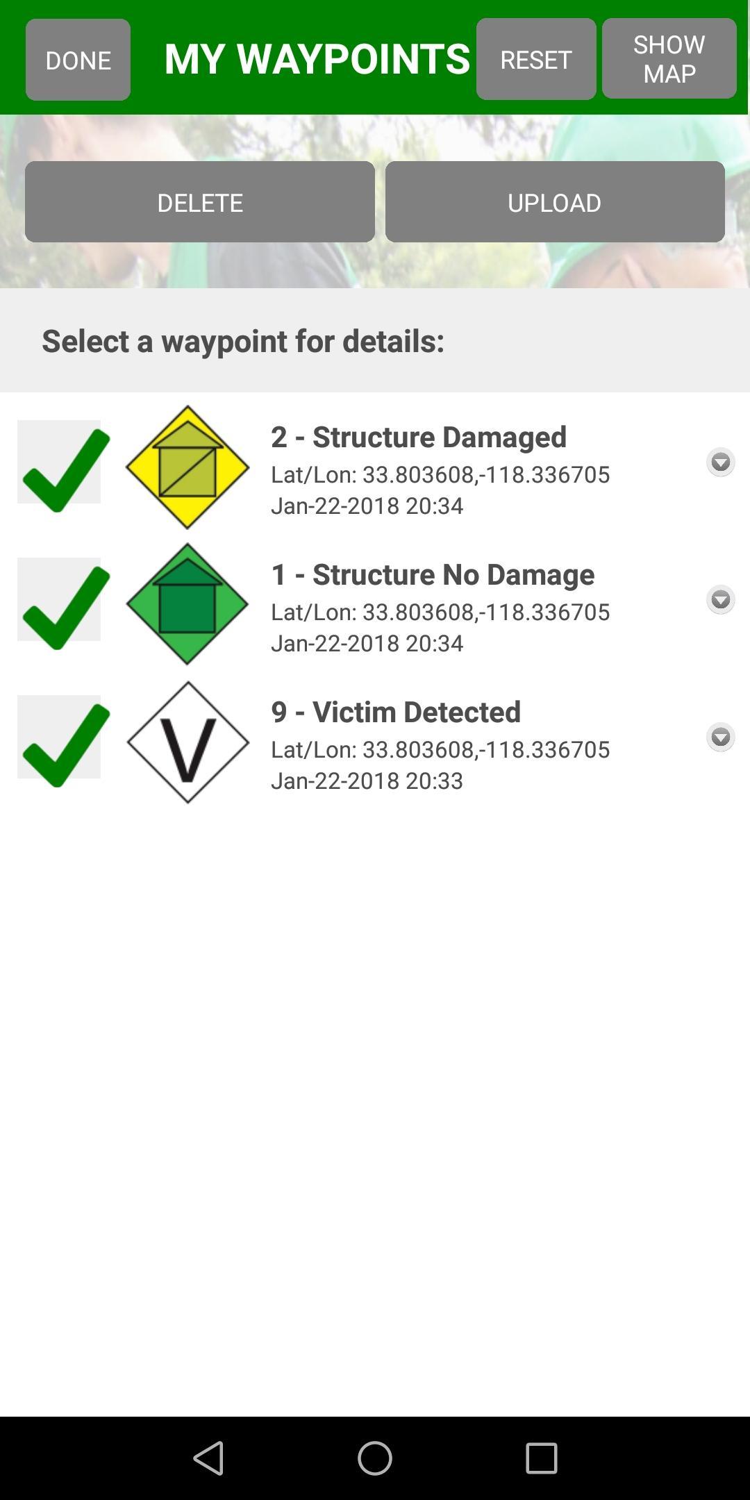
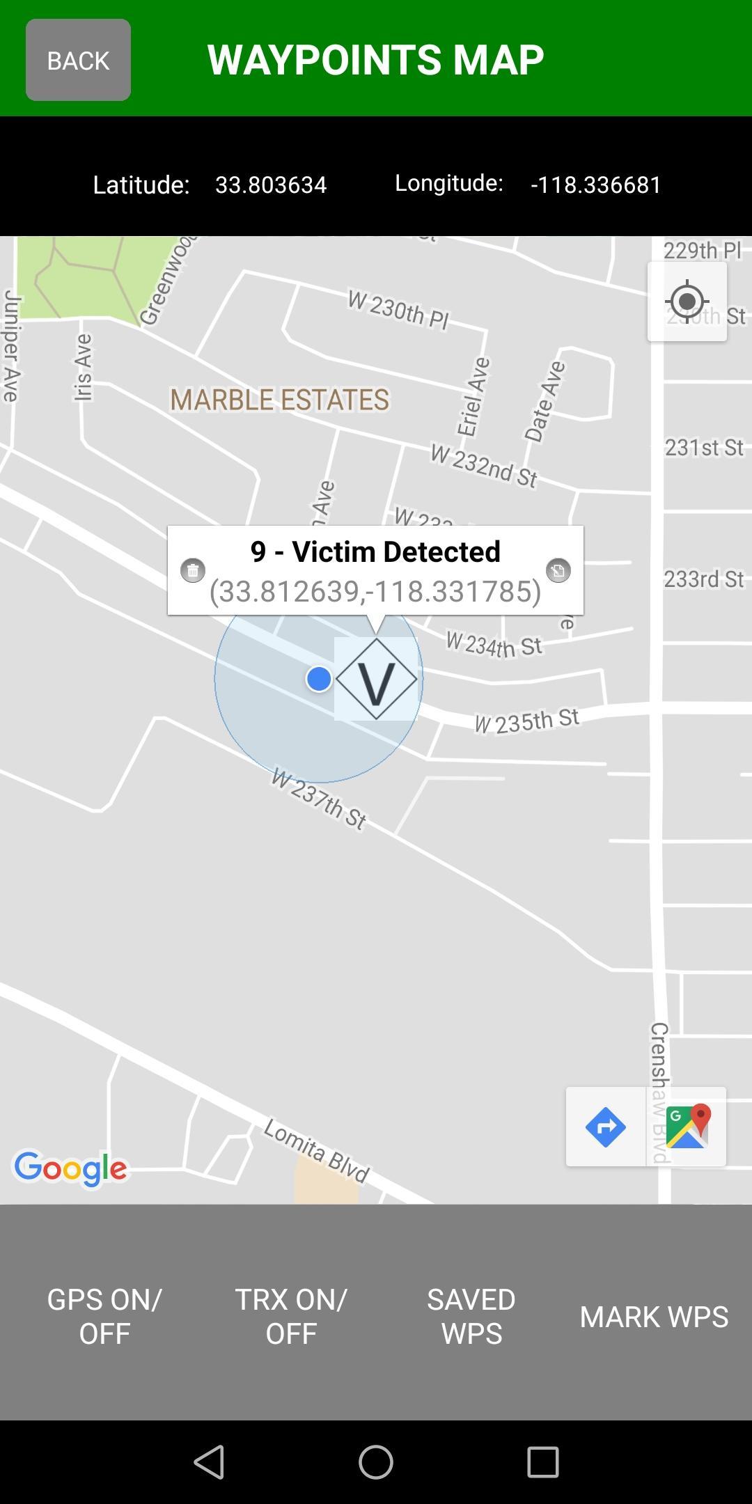
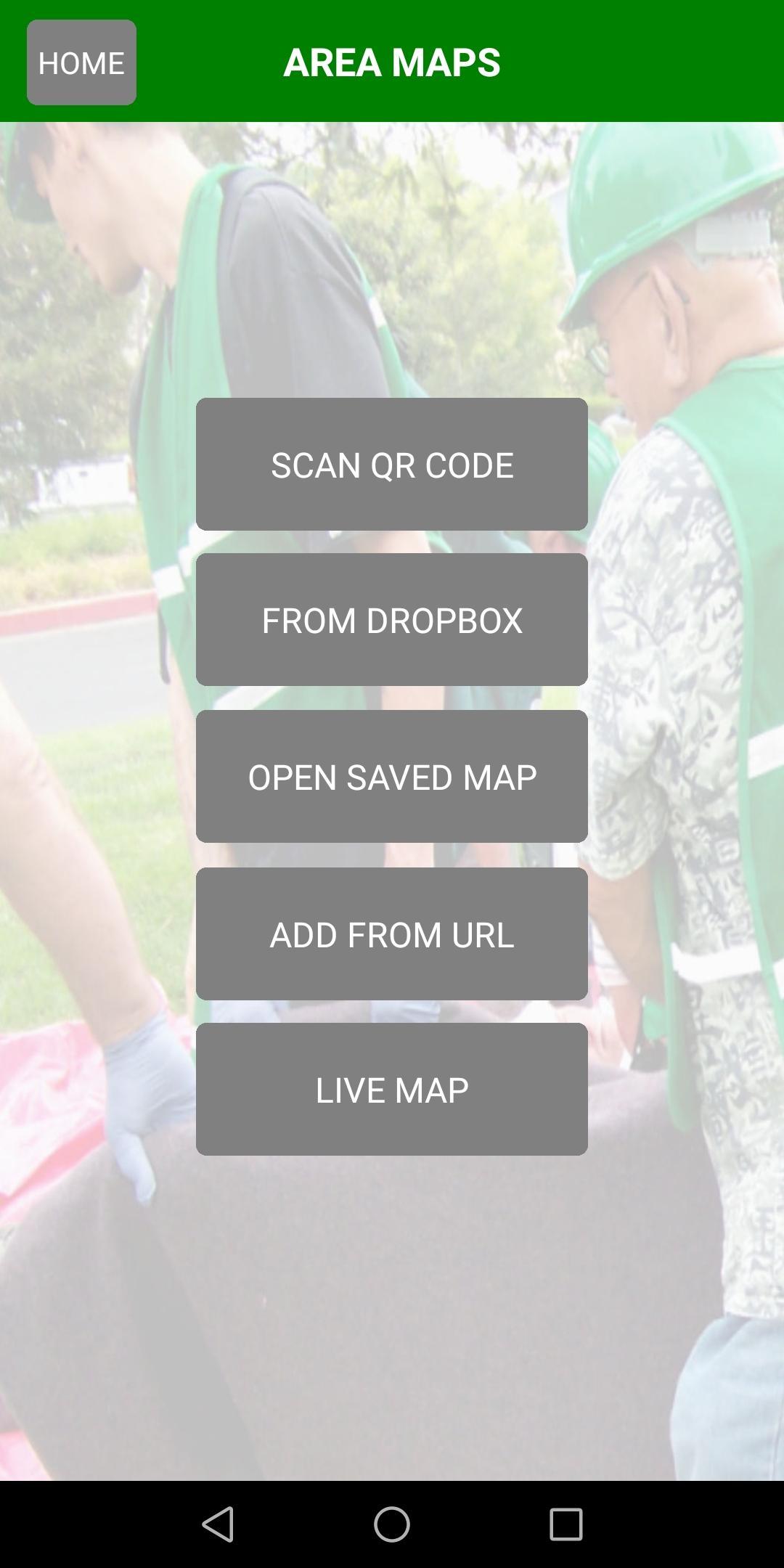
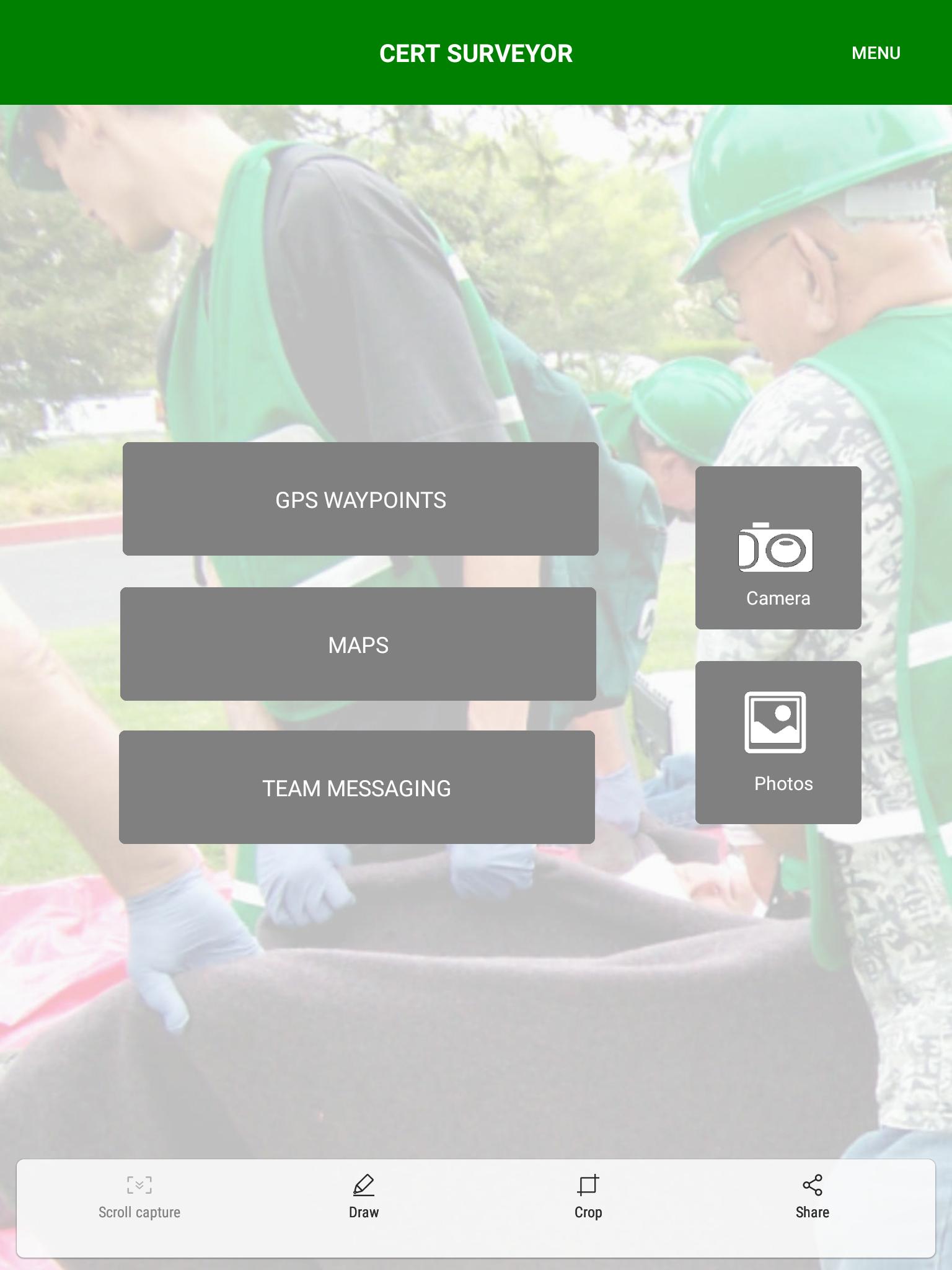
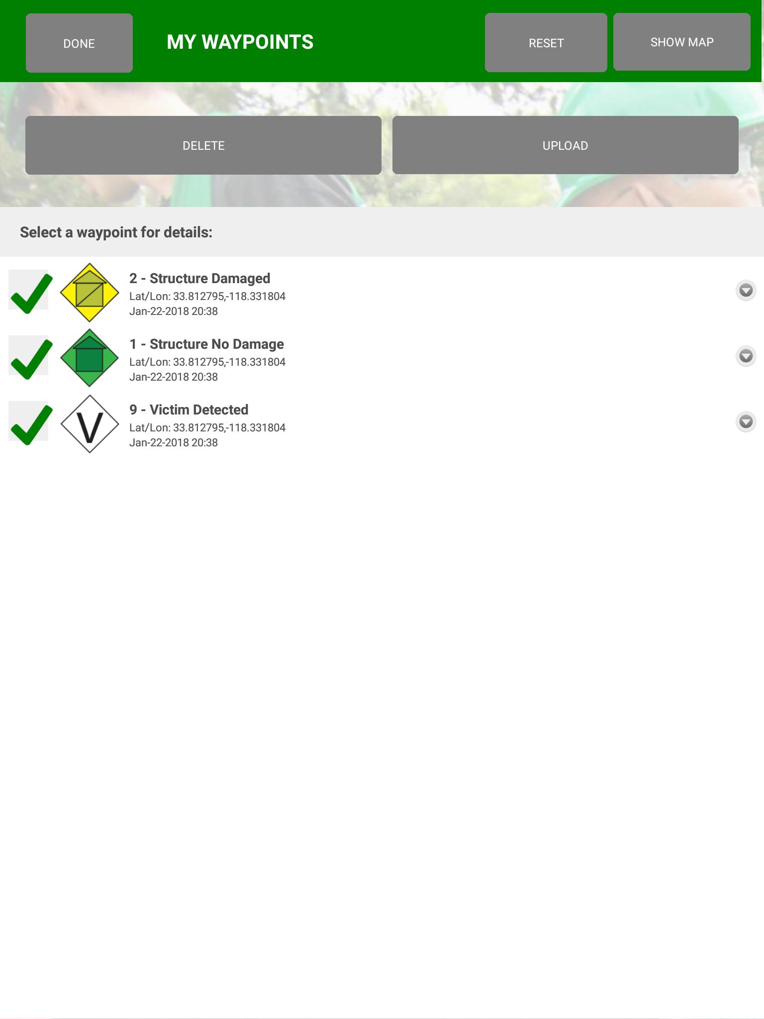
CERT Surveyor由社區緊急第一響應者設計,用於收集信息以幫助協調搜索和救援行動。該應用程序使用標準FEMA CERT圖標在地圖上刪除航點,允許以可變間隔和距離增量創建軌道,並加載pdfs地圖以及使用航點圖標創建實時地圖。所有數據都可以上傳到隨附的網站帳戶,並以KML或GPX文件格式下載數據,以便導入ArcviewGIS和其他GIS製圖平台。
團隊經理/領導者:請聯繫[email protected],讓您的CERT Surveyor帳戶升級為團隊領導者版本,該版本可以查看網站上已在應用程序中註冊相同團隊代碼的所有團隊成員。
Last updated on 2021年03月03日
(a) Fixed issue with loading pdf maps from URL not working; (b) Fixed QR code reader not starting in maps section; (c) If waypoints were checked and upload pressed while in airplane mode, screen would freeze; now fixed;
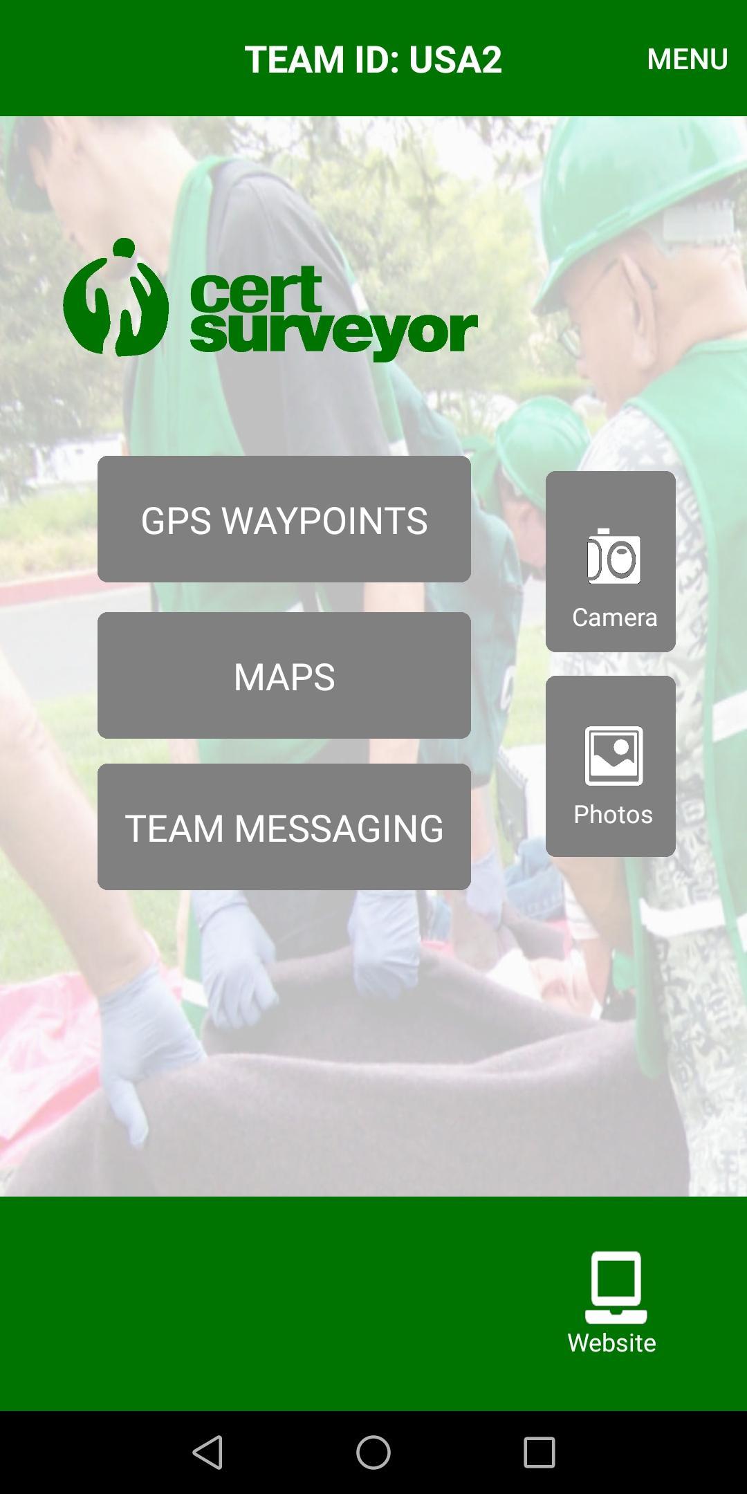

CERT Surveyor
3.35 by Andrew Olvera
2021年03月03日