Use APKPure App
Get Canary Islands Map Navigator old version APK for Android
Deniz ve Balıkçılık Grafikler - avucunuzun bir GPS çizici gücü
Flytomap is a valid and interesting alternative, Benetti Yachts
Featured on the Deck
Featured on Geomedia
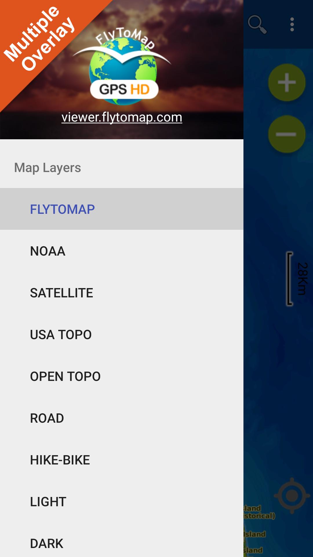
Worldwide Marine and Outdoor Maps available when connected, thanks to viewer.flytomap.com
Worldwide Satellite images overlay on charts
Worldwide Terrain features overlay on charts, thanks to Open Street Map, Open Cycle Map, Bing,Earth,GMap,topo maps by ESRI
Live AIS now available
Real time map view of your boat and boats near you, worldwide.
No AIS receiver required, just your mobile!
Various icons depict different vessel categories.
Select any target to see vessel details such as name, MMSI, IMO, call sign, status, speed, heading, coordinates, distance from your GPS location, and more
Now with NOAA raster charts seamless with continuous updates from the official Government server
Now with ActiveCaptain - Worldwide boaters community * 200.000 + Captains
Use to Explore:
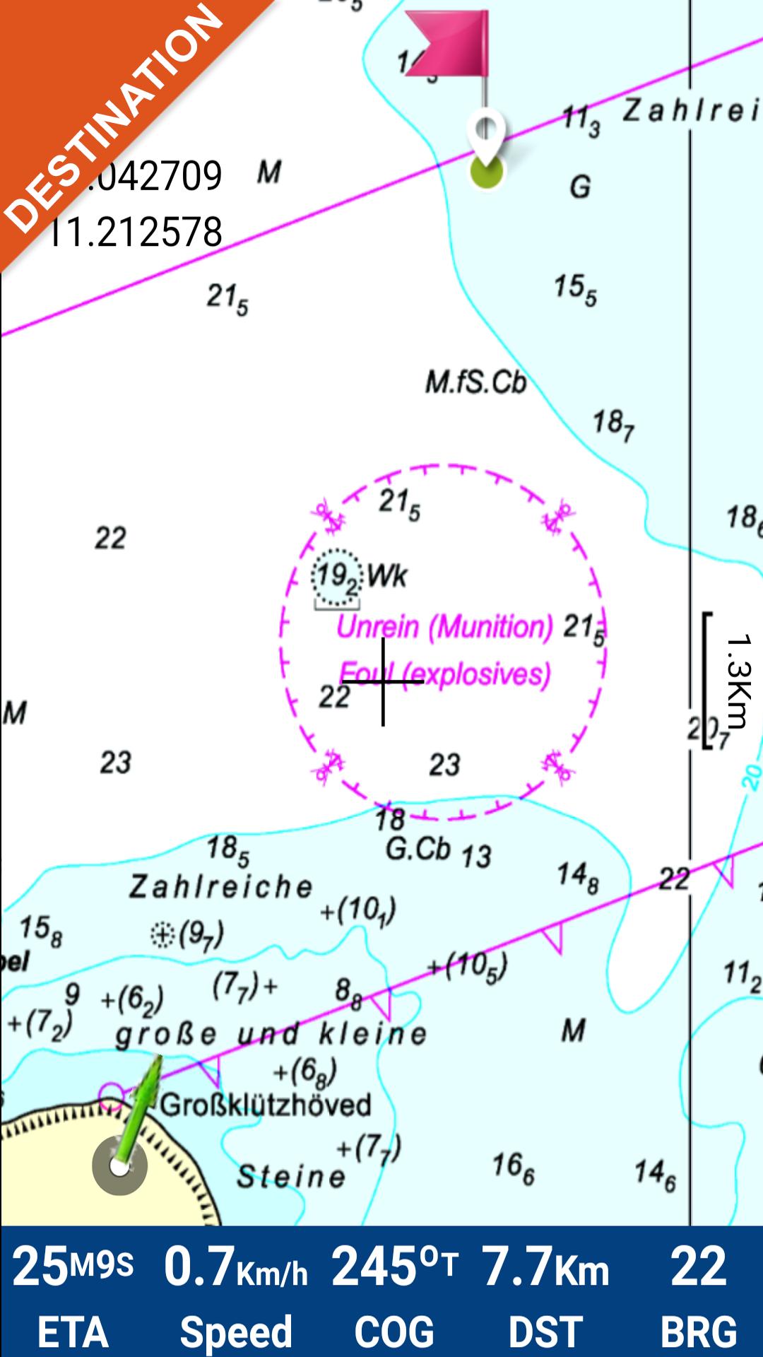
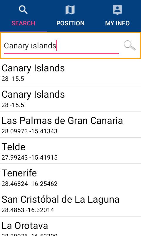
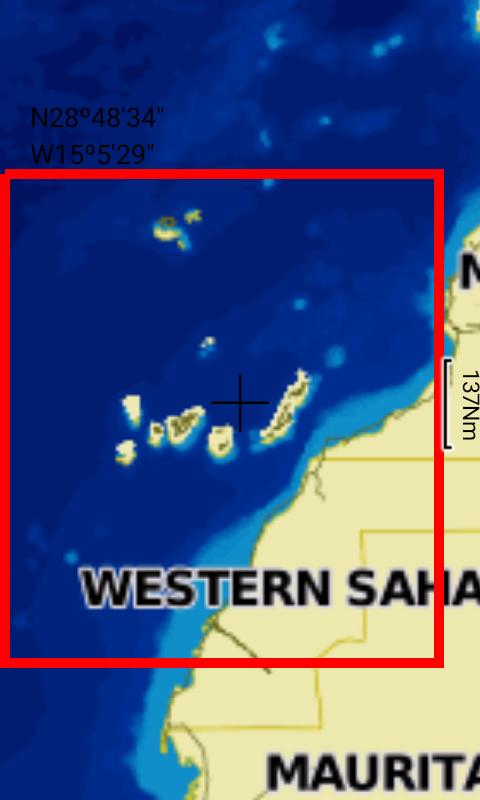
√ Latitudes and Longitudes to go to your favorite places
√ Search your Favorite points directly
√ Zoom, Rotate and Pan fast just by a finger touch
√ Geocompass
√ Navigate and see your GPS position on the map
√ Heading Vector Towards the direction movement
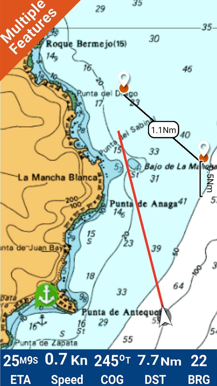
√ Distance Measurement Tool to easily calculate the distance from one location to another
√ Insert the target/destination and see in real time your speed, distance and bearing
√ background mode - Flytomap works in background as well, you can swap with another app and receive/make calls send sms while panning and zooming.
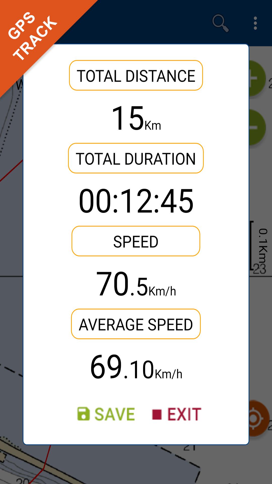
√ Unlimited Tracks share via email, visible on Google, Flytomap Viewer, KMZ format - Store your track without the need of cellular data or mobile signal
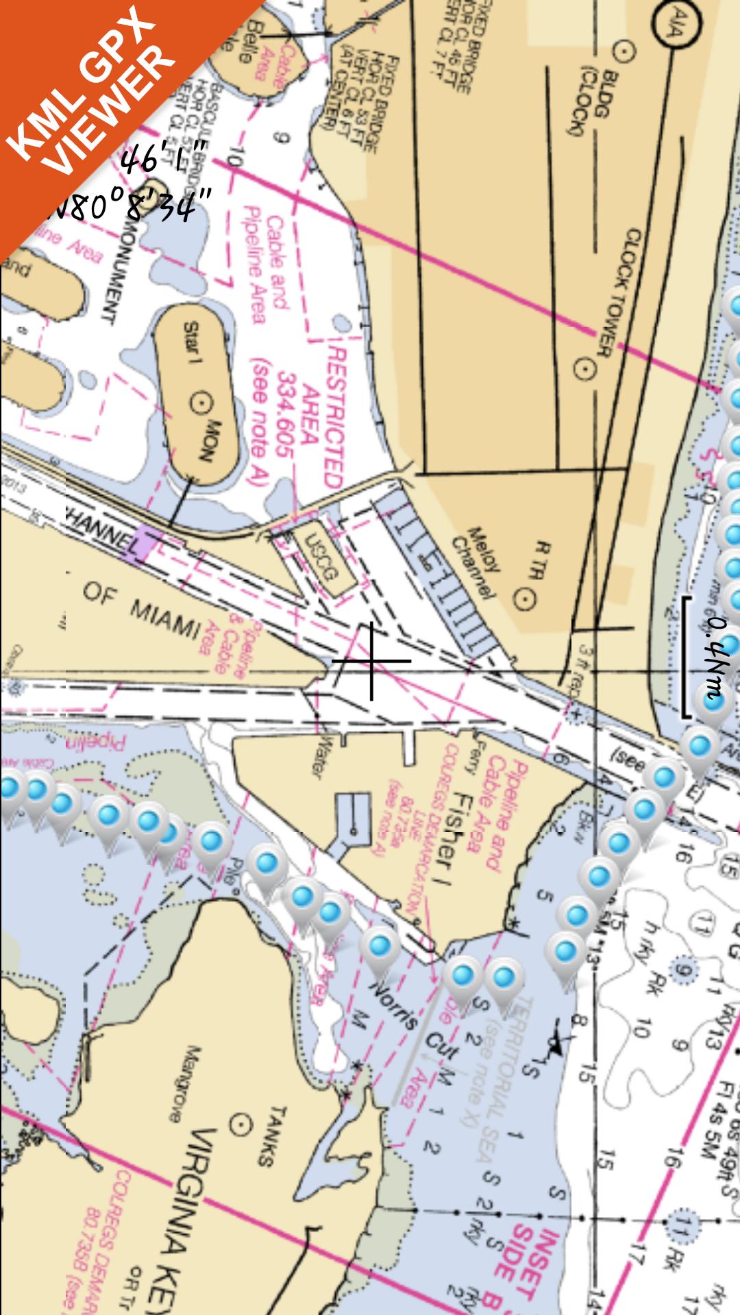
√ KMZ KML from / to GPX Converter
√ Optimized battery usage
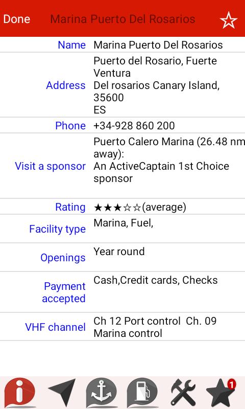
√ ActiveCaptain
• View and contribute to the best boaters community available in the world
• Continuous update of all info (including reviews from the deck) about :
• Marinas
• Anchorages
• Hazards
• Local Knowledge
√ And so much more to come - It’s the only app you will ever need! Our charts are installed on: GARMIN NAVICO LOWRANCE B&G NORTHSTAR EAGLE SIMRAD
Follow us:
▶Twitter @flytomap
▶Web Site flytomap.com
▶Web App viewer.flytomap.com
▶Facebook facebook.com/flytomap
Flytomap is committed to constant improvement, this App is developed with the help of professional boaters to get the best experience on the sea, we listen to our users and systematically add the most requested features.
Thank you for the feedback!
Additional info about Flytomap products
WATER MAPS (Marine):
Water map navigator is the new ‘Marine Navigator for all mobile devices contains embedded Electronic Nautical Charts (ENC) from NOAA compressed to a large coverage.You can now download the application and transform your Phone in a chart plotter with best NOAA, ENC S57 cartography; which includes Anchoring areas, Fishing areas,restriction areas, obstructions, rocks, Buoys, Beacons, Lights, Depth contours with Values display on map, Spot Soundings and more. The only marine app’s available in the market with such huge information. Every effort is made to be as accurate as possible when presenting information for every destination.
TRAVEL MAPS:
These Maps treat you mostly with information of both Marine and terrain correspondingly. These are the most preferable Maps to travel especially for fascinating recreational voyages, map focus the best Beach spots along the Coast line, Major ports, Sailing, Fishing, Picnic areas, Parks, Hiking, Biking, Clubs, restaurants,Famous Hotels, Museums, Shopping areas, and much more. Introducing guide in map navigator for easy references, you can use it without any Active Internet connection!
“We work to delight your moments”
! Enjoy great Journeys!
Last updated on Dec 14, 2021
Minor bug fixes and improvements. Install or update to the newest version to check it out!
En Son Sürüm
![]() 4.4.3.7.3
4.4.3.7.3
Gereken Android sürümü
5.0
Available on
![]()
Kategori
Bildir
Discover what you want easier, faster and safer.

Canary Islands Map Navigator
4.4.3.7.3 by FLYTOMAP
Dec 14, 2021
$3.99