Use APKPure App
Get Parcelles Explorer old version APK for Android
Mapping of the Fr cadastre, real estate sales (DVF), PLU, DPE, etc.
'Parcelles Explorer' is a mobile real estate mapping application
It is aimed at both real estate professionals and individuals:
✓ prospecting,
✓ location of real estate from an ad,
✓ informational monitoring of the market,…
✓ search for real estate (house, apartment or land),
✓ estimation of prices practiced in a sector,
✓ consultation of zones and town planning documents, etc.
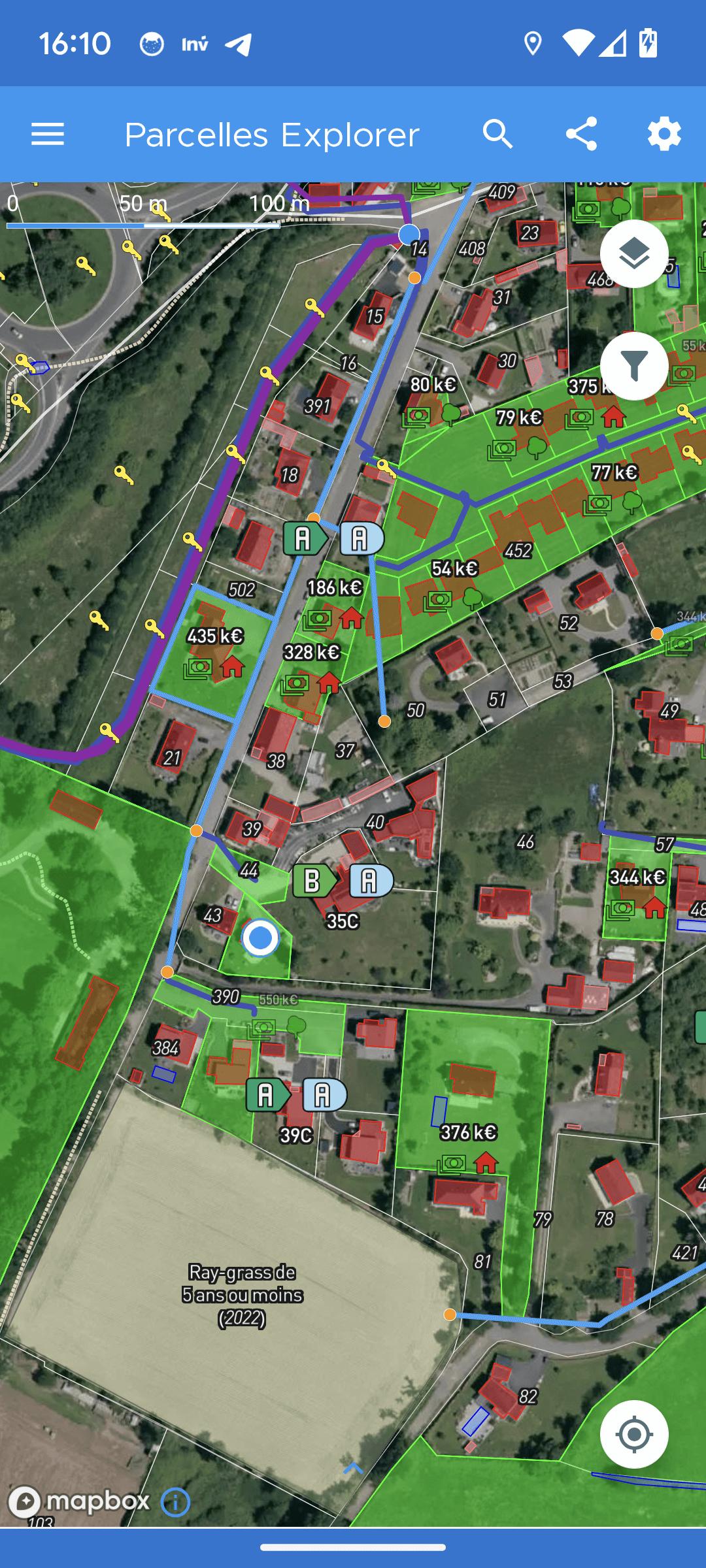
It allows you to visualize for mainland France and the overseas departments:
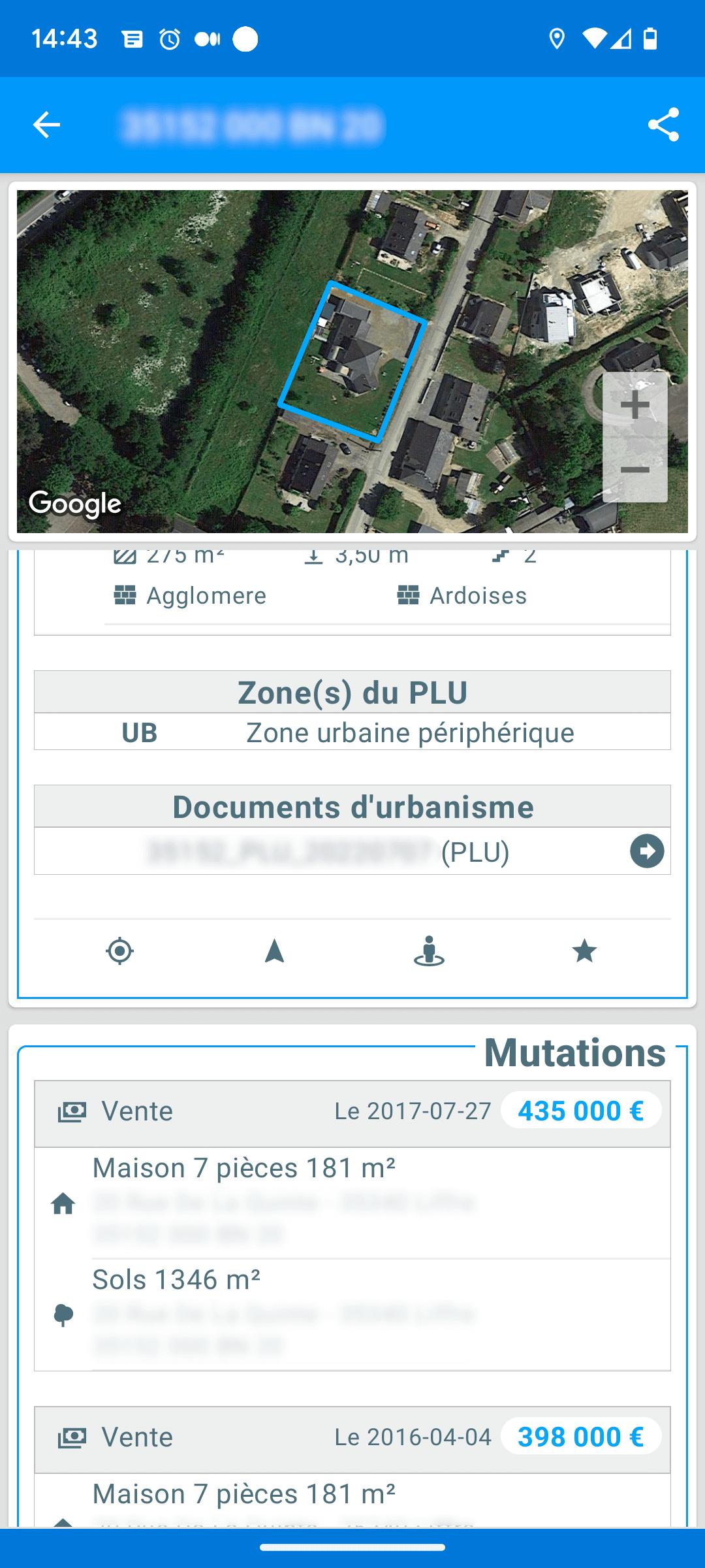
✓ the land register: municipalities, plots, buildings, swimming pools, etc.
✓ real estate transactions since 2014 (DVF data / Land Value Requests),
✓ street numbers (BAN)
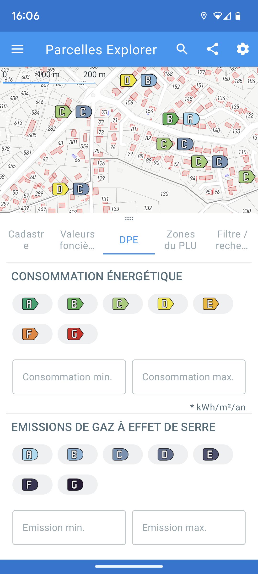
✓ almost all of the information on the first 3 pages of the DPE produced since July 2021
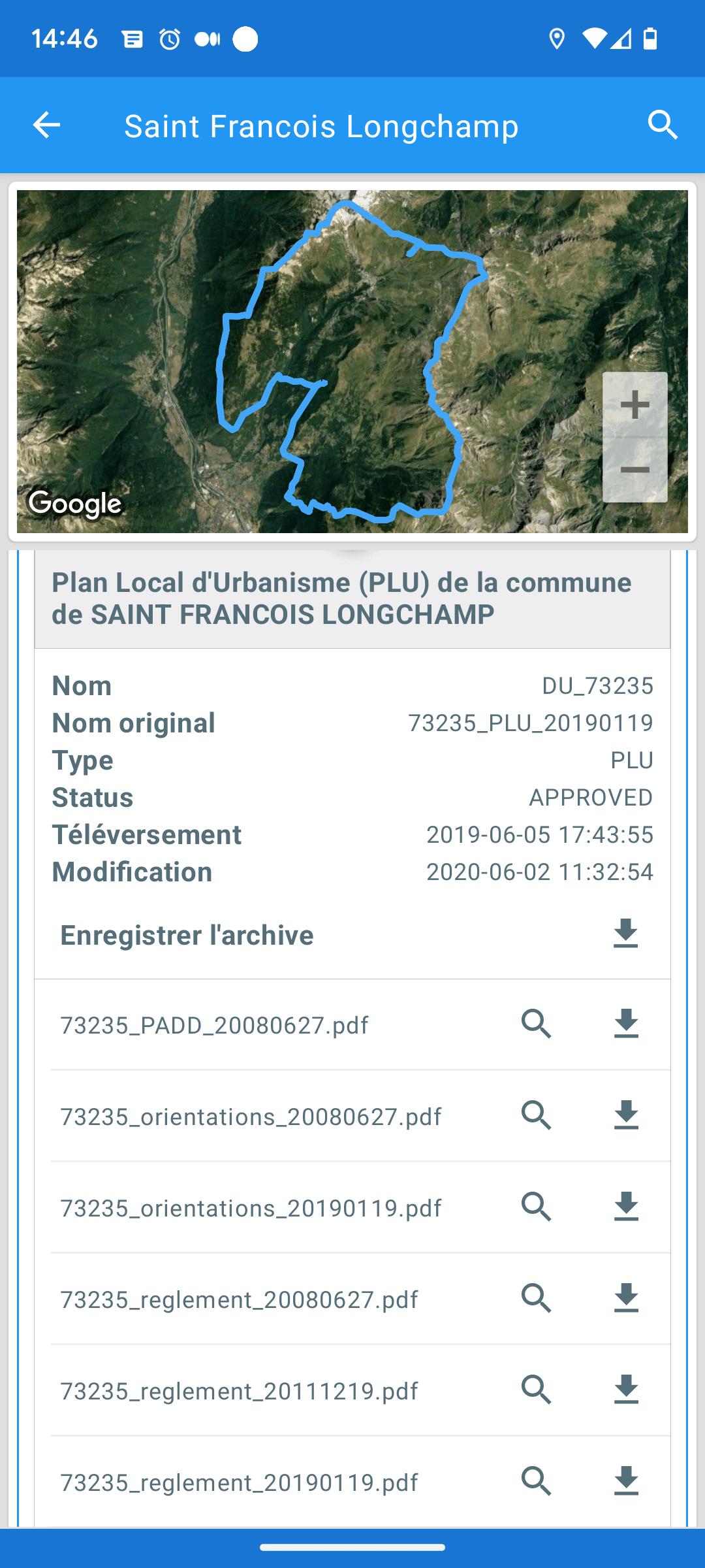
✓ the Local Urban Planning Plan (PLU): urban planning zones, documents, etc.
✓ surface objects (buildings, swimming pools, etc.): area, nature, year of construction, etc.
✓ co-ownerships,
✓ legal entity owners,
✓ aerial and underground mapping of lines (HTA/BT) and substations operated by Enedis,
✓ the graphic parcel register (use of agricultural land in the territory),…
Locating plots is done easily and quickly using:
✓ its land registry number
✓ his address,
✓ its geographical coordinate,
✓ of the card,
✓ the geolocation of the mobile, directly on the ground,
✓ or the plot search engine (based on criteria taken from real estate advertisements),…
The application is based on official datasets published as open data:
✓ the land register (Etalab),
✓ requests for land values (DVF data from the DGFiP),
✓ DPEs since July 2021 (ADEME open data portal),
✓ the local town planning plan (urban planning geoportal or GPU),
✓ the topographical database (IGN Topo BD),
✓ the national address database (BAN),
✓ the National Register of Co-ownership Registration (RNIC),
✓ the file of premises and plots of legal entities,
✓ the graphic parcel register (RPG)
This data is updated quickly after the release of new updates.
The app is free for basic features, subscriptions are offered for:
✓ activate certain map filters,
✓ display street numbers on the map,
✓ display the DPEs carried out since July 2021 and access their details,
✓ display urban planning zones,
✓ display the co-ownerships,
✓ display the owners legal entities,
✓ display the ENEDIS network
✓ download town planning documents,
✓ search by address and plot number,
✓ remove advertisements,
✓ display certain base maps (satellite, etc.),
✓ access the advanced search tool for plots and DPEs.
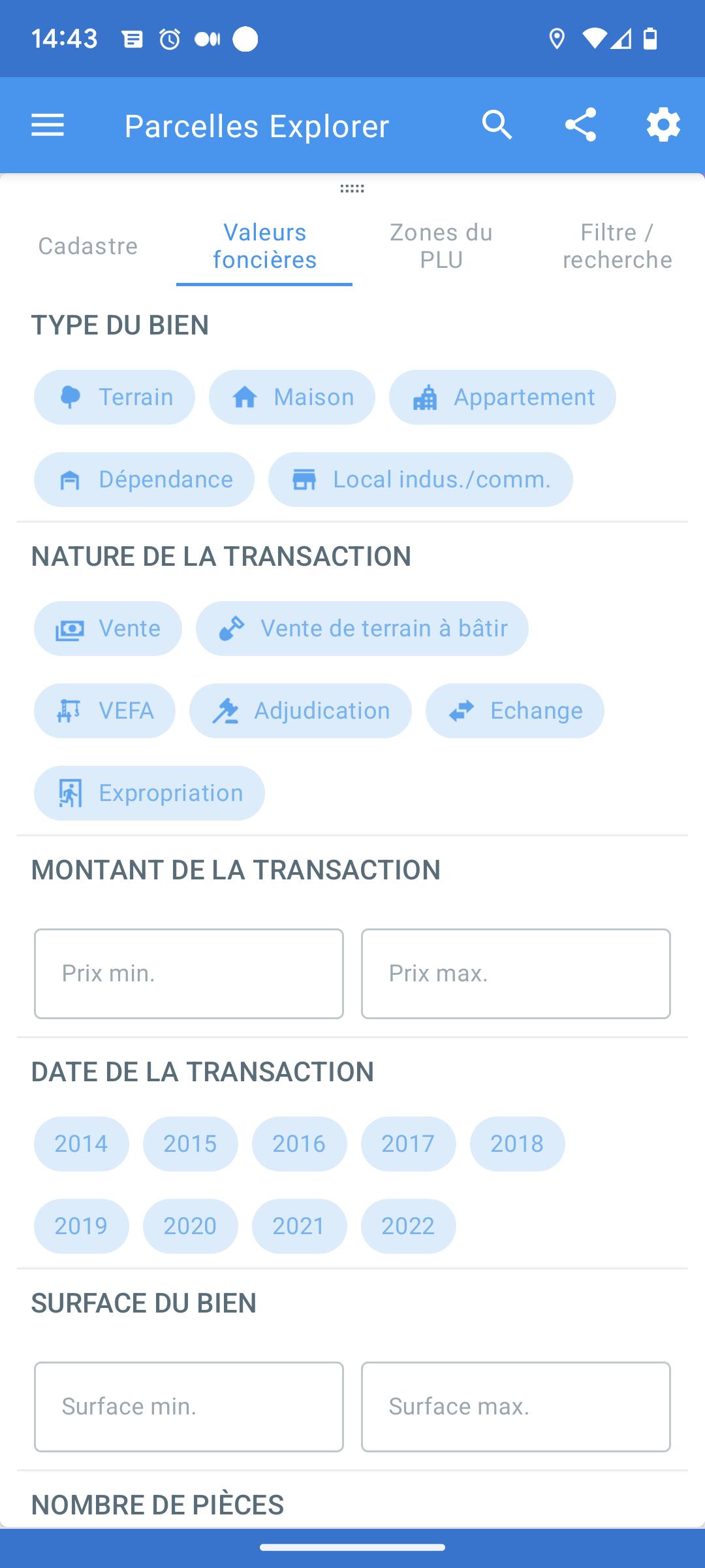
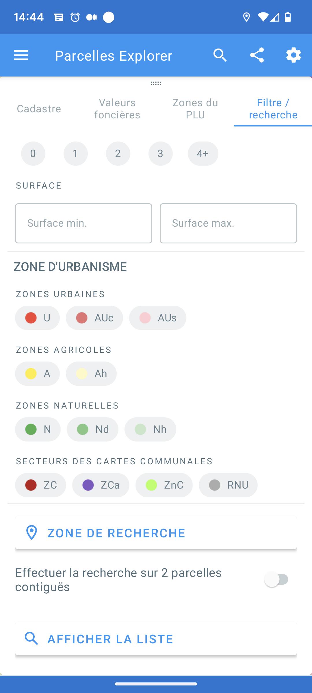
The advanced land registry search tool, available only by subscription, allows you to identify a list of plots meeting certain criteria:
✓ surface area of the plot,
✓ presence or absence of surface objects on the plot (building, swimming pool, lake, etc.)
✓ influence of these surface objects on the plot,
✓ search area (city),
✓ urban planning zone,
✓ possibility of applying all these criteria to one or more contiguous plots.
The tool therefore makes it relatively easy to find a property based on a sales announcement.
The advanced DPE search tool, available only by subscription, allows you to identify a list of DPEs meeting certain criteria:
✓ DPE indices,
✓ date of creation,
✓ main energy of the heating and domestic hot water production system,
✓ search area (city),
The tool therefore makes it relatively easy to find a property based on a sales announcement containing DPE information.
For any suggestions, comments, requests, or bug reports, contact us by email
Last updated on Dec 16, 2024
- Ajout du registre parcellaire graphique (historique depuis 2019)
- correction de bugs
Latest Version
![]() 1.0.8
1.0.8
Uploaded by
Sandro Japaridze
Requires Android
Android 6.0+
Available on
![]()
Category
Report


Discover what you want easier, faster and safer.

Parcelles Explorer France
1.0.8 by Dje073
Dec 16, 2024