Use APKPure App
Get onX Hunt old version APK for Android
Plan your hunt with topo maps, property lines, GPS navigation, and map layers
Navigate your next hunt with topo maps, GPS navigation, species distribution, hunting units, and more. Know where you stand by viewing private and public land ownership data and landowner names. Maximize your hunting experience with onX Hunt.
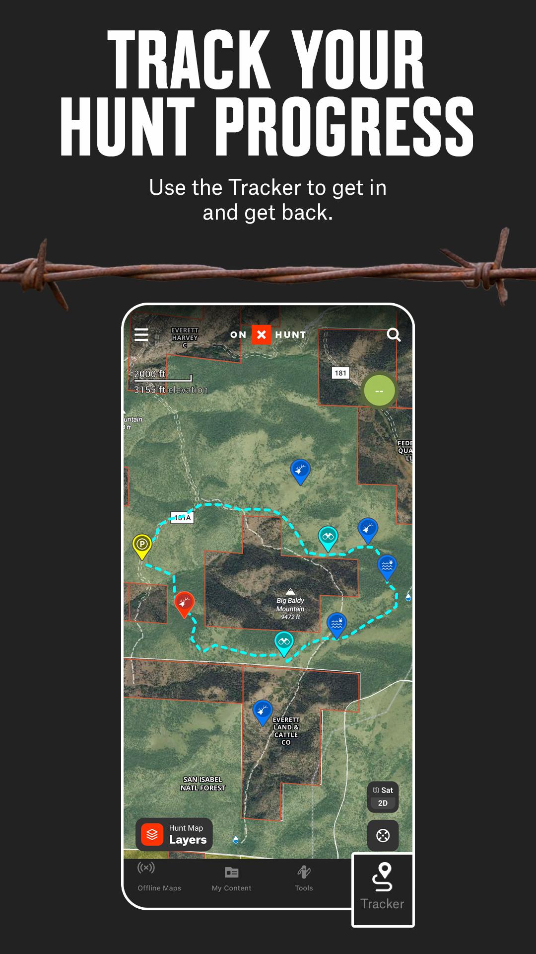
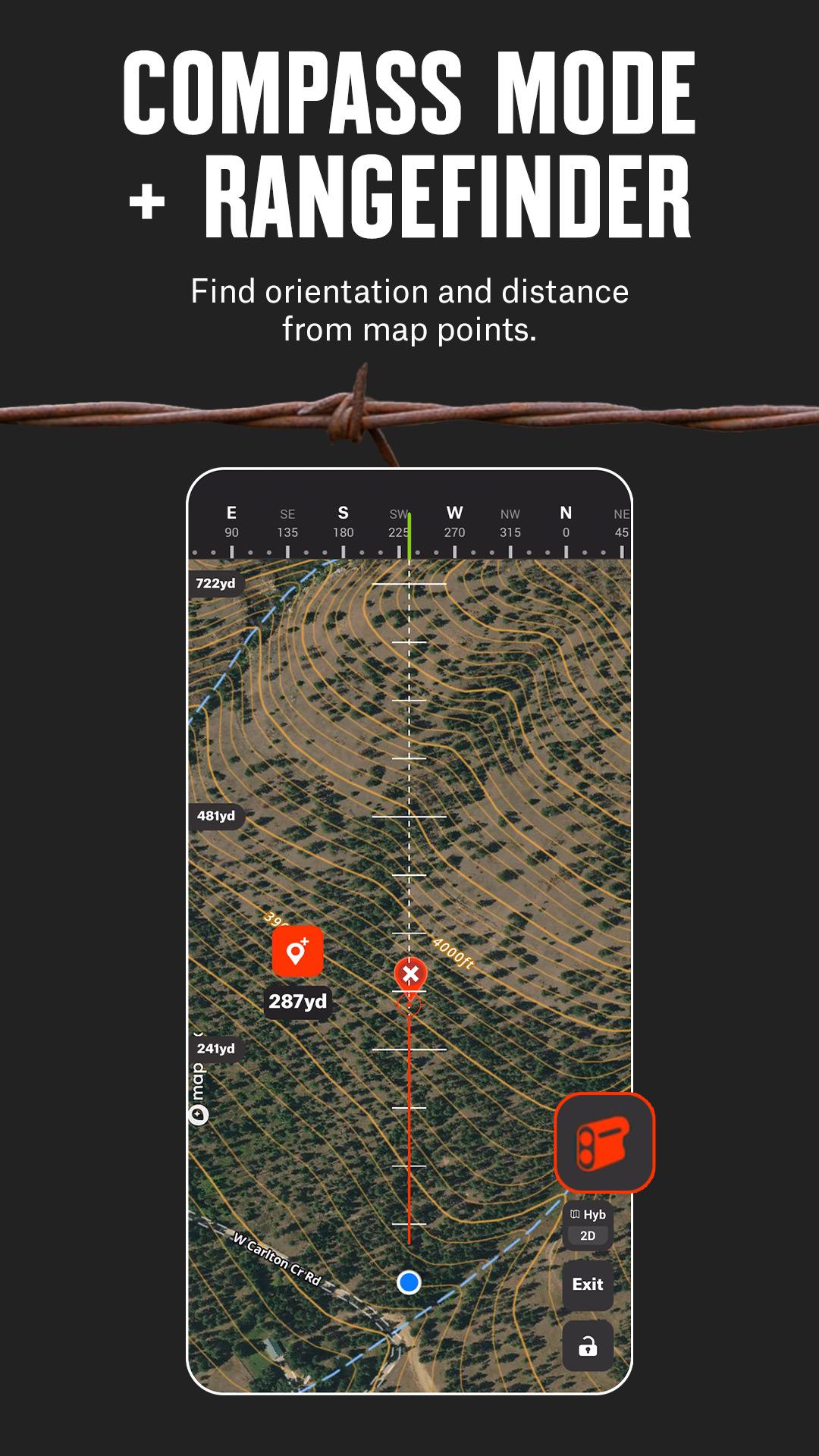
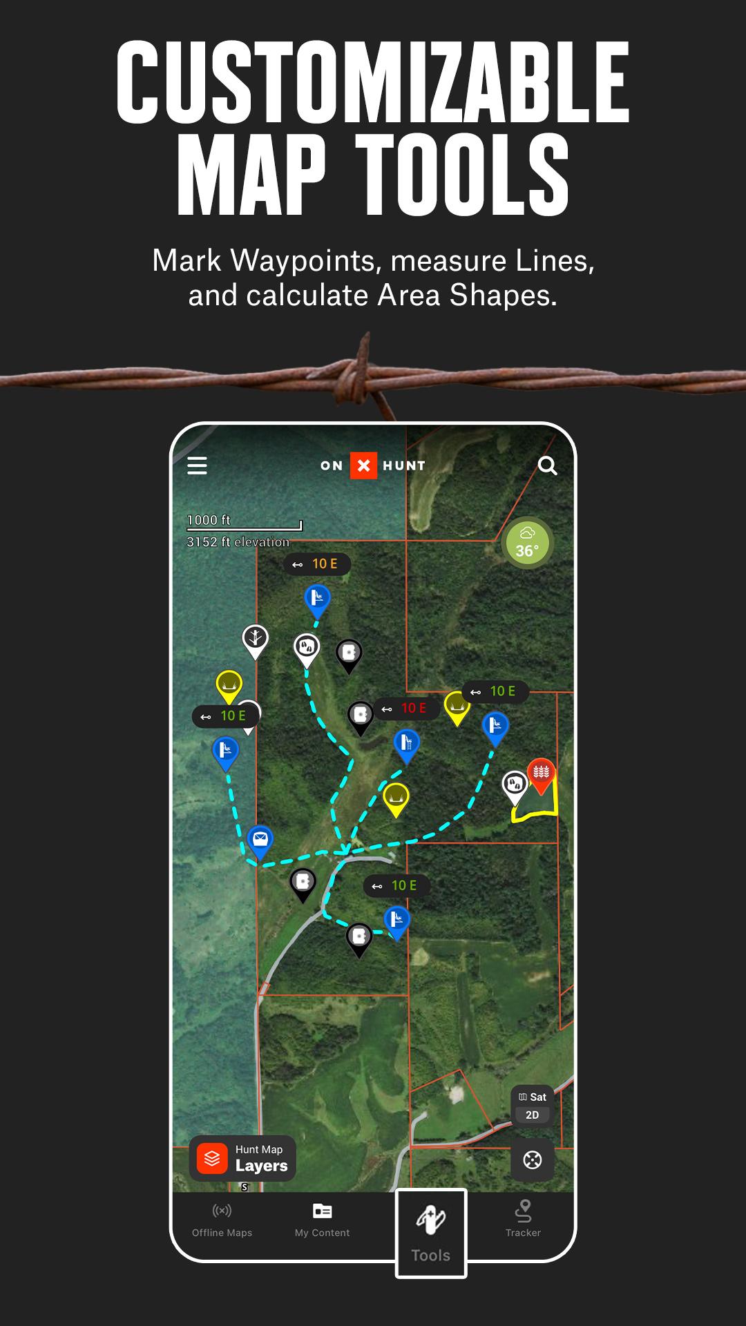
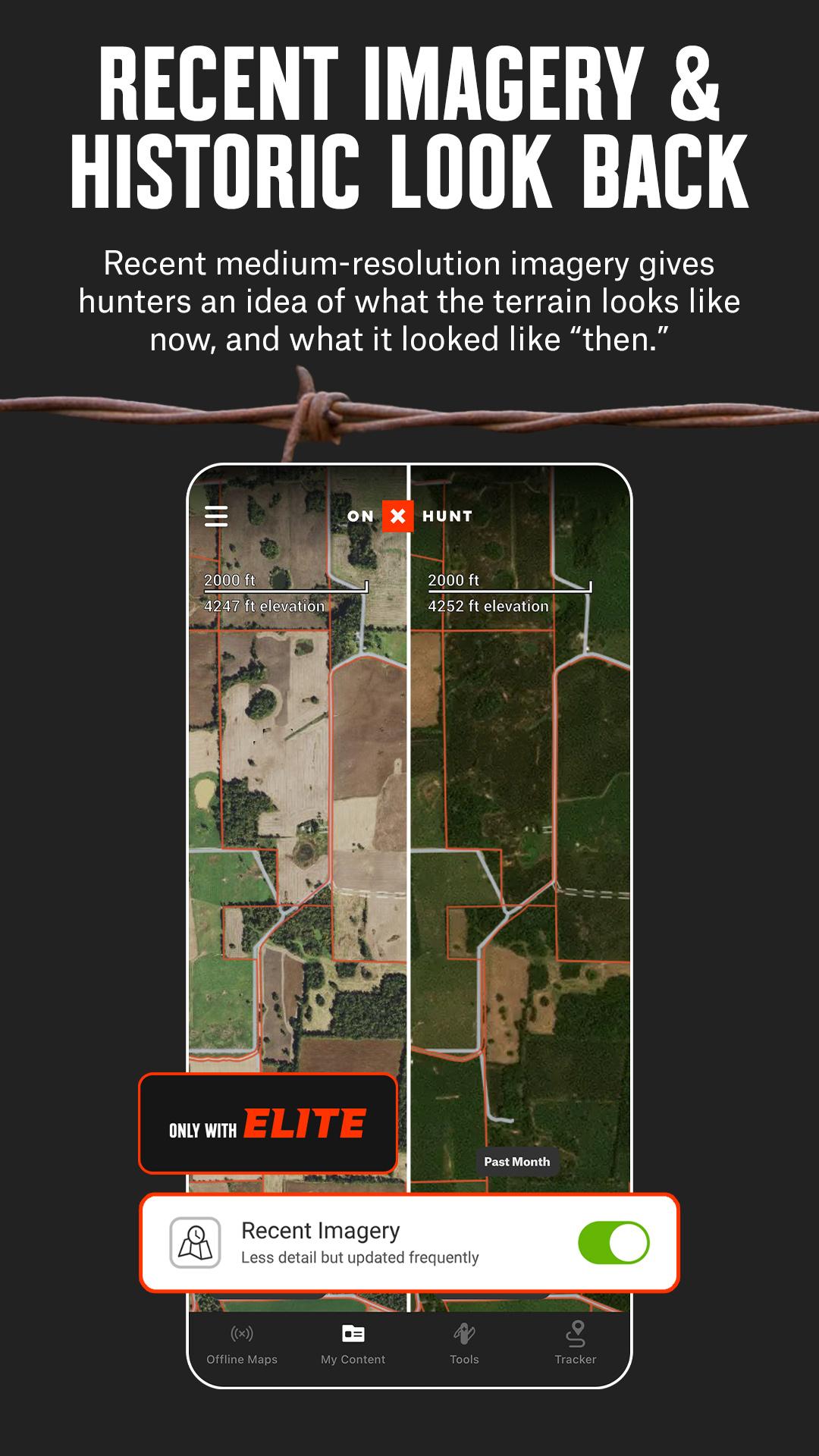
View topographic maps to plan your hunt or toggle between satellite and hybrid basemaps. Open 3D maps, mark crucial locations with Waypoints, and measure the distance to the nearest access point with Lines. Save offline maps to go as far from the grid as you want.
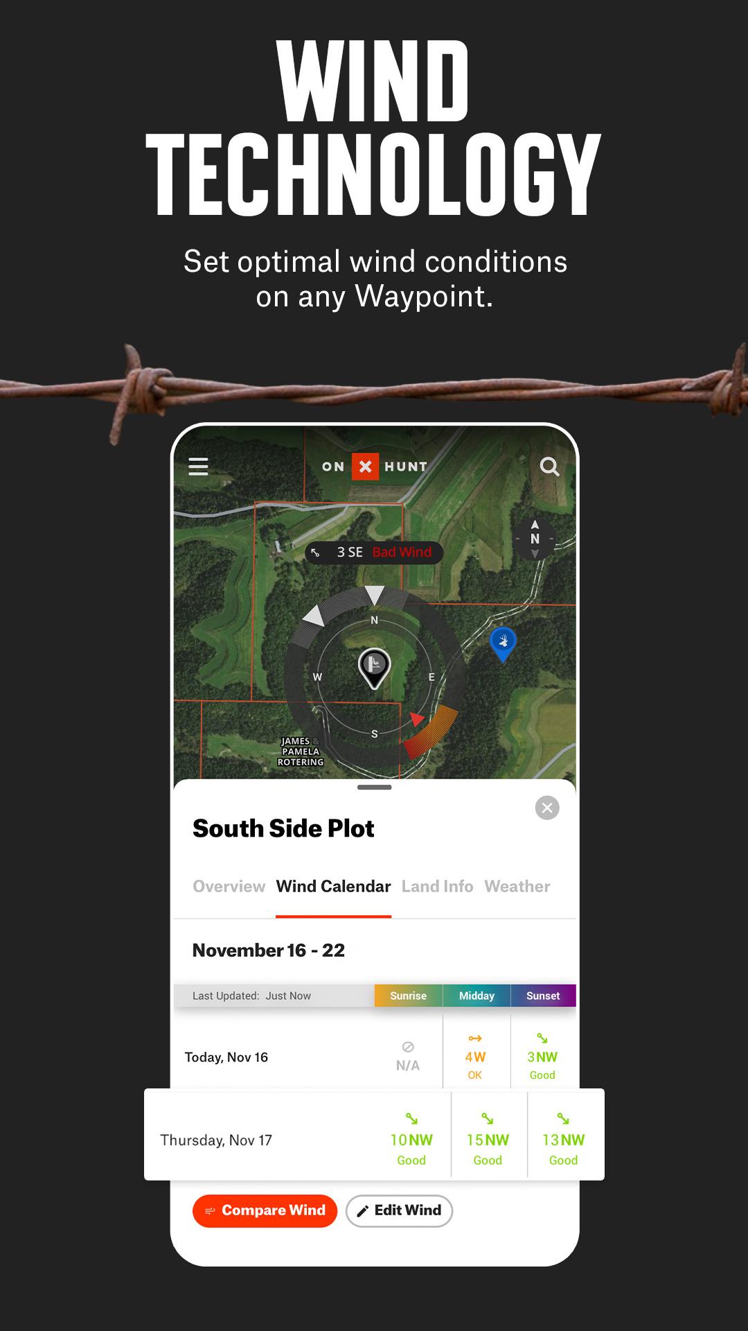
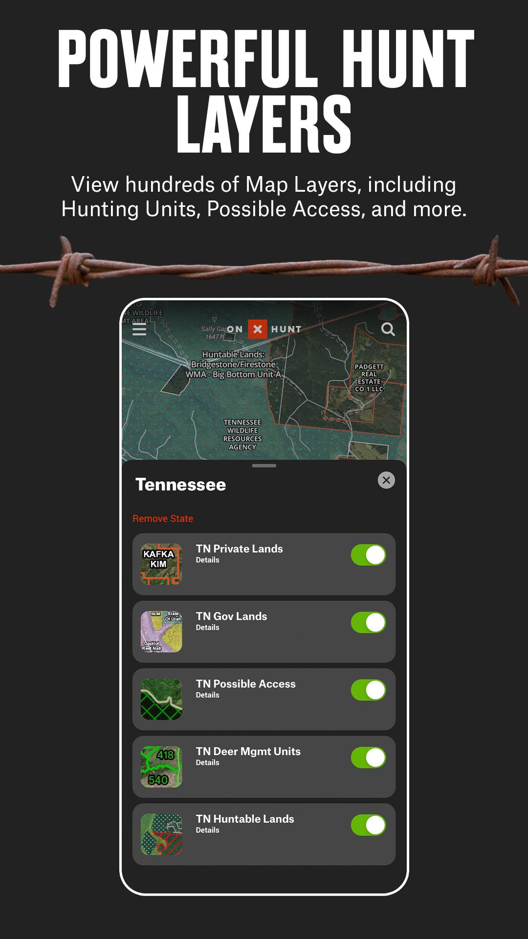
Map property lines to hunt with confidence and find new opportunities nationwide. Monitor weather conditions, wildlife distribution, and data on trees, crops or soil by switching between custom map layers. View trail cameras for recent activity and wind calendars for stand locations.
Access a GPS navigation app direction on your phone or instantly drop a Waypoint from your wrist using Wear OS. Stay focused on the hunt and enhance your safety and efficiency in the field by removing the need to look at your phone.
Discover new access, find more game, and hunt smarter with onX Hunt.
onX Hunt Features:
▶ Public & Private Land Boundaries
• Access land boundary data and property line maps with landowner names (U.S. only)*
• Plan ahead with info on GMU or Hunting Units. Study county and state land hunting maps
• View public land with Forest Service or Bureau of Land Management (BLM) maps
• Observe state lines and locate Wildlife Management Areas, Timber Lands, and more
* Private land ownership maps may not be available for all counties (U.S. only)
▶ Offline Maps & Custom Layers
• View 2D or 3D maps to understand the terrain and visualize your hunt
• Topographic maps, satellite or hybrid basemaps. Take advantage of easy-to-read visuals
• Save detailed offline maps with your Layers, Markups, and Waypoints
• Monitor weather conditions, wildlife and tree distribution with Map Layers
▶ Hunt Planner & Tracker
• Measure distance between two points with the Line Distance Tools
• Map routes, mark locations, view Optimal Wind and save access points
• GPS navigation and tracking. Log your hunt, monitor duration, distance, and speed
• Scout from the comfort of your home with Desktop Maps
Our memberships also include access to our online Web Hunting Map. Sync markups and tracks between devices, and print unlimited free maps. (www.onxmaps.com/web)
▶ Free Trial
Start a free trial when you install the App and select your state of choice.
▶ State Memberships:
Access all of the features listed above and plan your hunt in a single state or two states. Hunt more game with land ownership maps, custom map layers, offline navigation, and more!
▶ Nationwide Membership:
The best tool for the best hunters. With a nationwide Membership, you get a complete, purpose-built solution for dedicated hunters and the game they pursue, including:
• Proprietary maps for all 50 states and Canada
• Advanced Tools: TerrainX 3D Viewer, Recent Imagery, Route Builder
• Exclusive pro deals and expert resources
• Draw Odds and Application Tools
▶ Government Information & Data Sources
onXmaps, Inc. does not represent any government or political entity, though you may find various links to public information within our services. For more info on any government information found within the services, click on the associated .gov link.
• https://data.fs.usda.gov/geodata/
• https://gbp-blm-egis.hub.arcgis.com/
• https://www.arcgis.com/home/group.html?id=00f2977287f74c79aad558708e3b6649#overview
▶ Terms of Use: https://www.onxmaps.com/tou
▶ Privacy Policy: https://www.onxmaps.com/privacy-policy
▶ Feedback: Have a problem or want to request new features? Please contact us at [email protected]
Last updated on Apr 3, 2025
Minor bug fixes and improvements. Install or update to the newest version to check it out!
Latest Version
![]() 25.12.0
25.12.0
Uploaded by
Mandeep Lakda
Requires Android
Android 8.0+
Available on
![]()
Category
Report


Discover what you want easier, faster and safer.
