下载 APKPure App
可在安卓获取Coordinate Plot的历史版本
自动化专业土地测量和地块划分引擎
坐标绘图 – 专业自动测量图绘制和地块划分引擎。
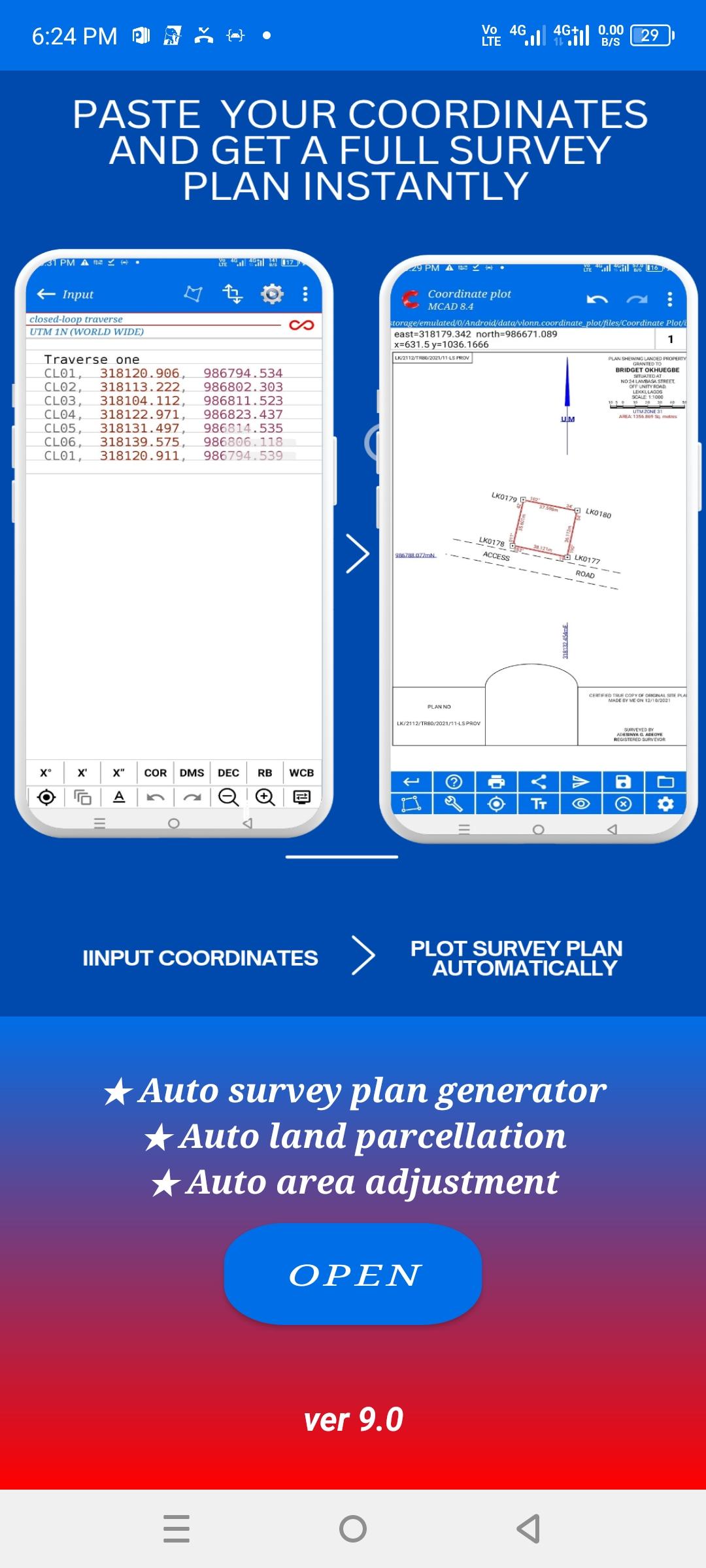
坐标绘图是一款专业的测量应用程序,旨在根据准确输入的现场坐标数据自动生成完整的测量图。它专为需要可靠工具进行实际测量和土地绘图工作的执业测量员、绘图专业人员、公司和测量机构而设计。
该应用程序支持标准测量工作流程,使专业人员能够高效地从现场数据生成完整的测量图,同时减少手动绘图时间并最大限度地减少错误。
它旨在减少手动绘图错误,消除重复计算,并帮助测量员更快速、更自信地工作。
坐标绘图并非一款休闲或实验性应用程序。它面向从事实际项目的专业人员,他们需要准确性、一致性和可靠的输出。
核心功能
坐标绘图软件专注于以下核心专业任务,所有功能均基于测量员输入的数据和专业判断:
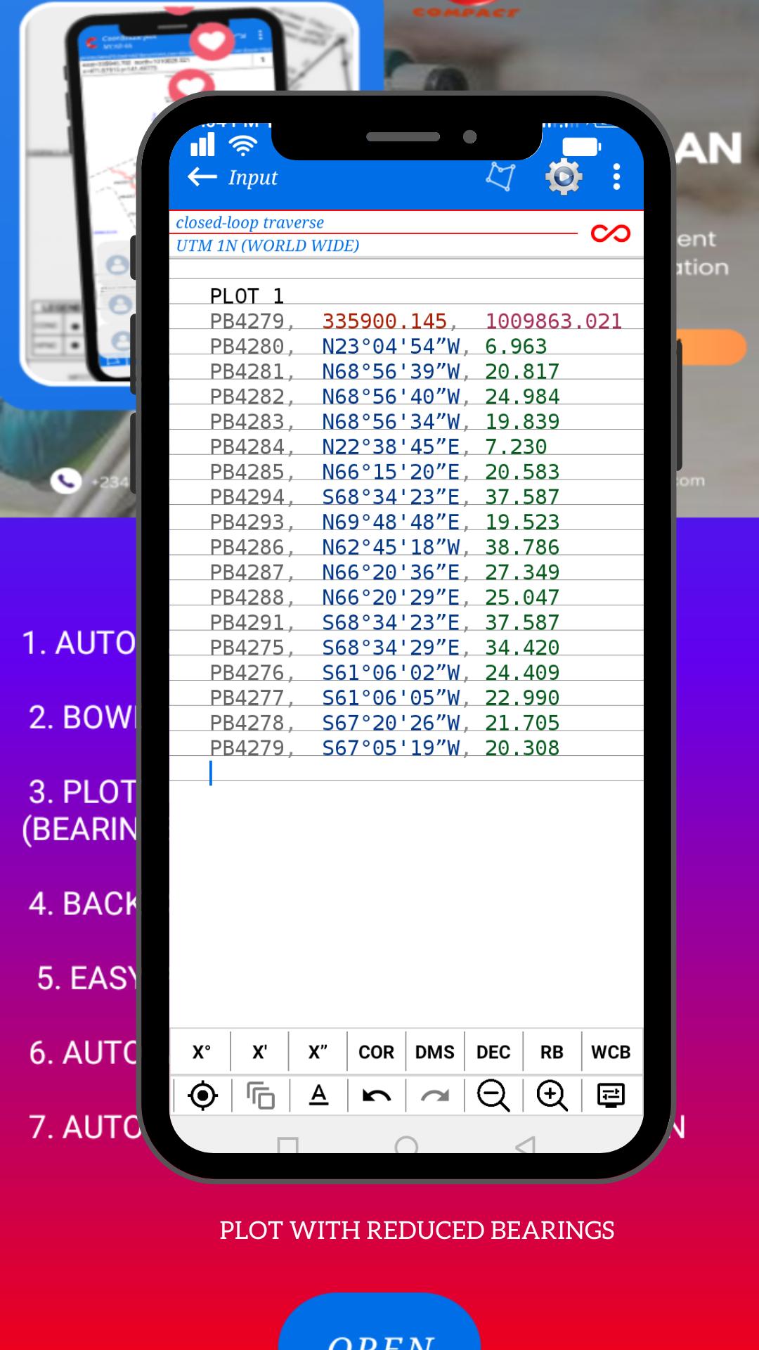
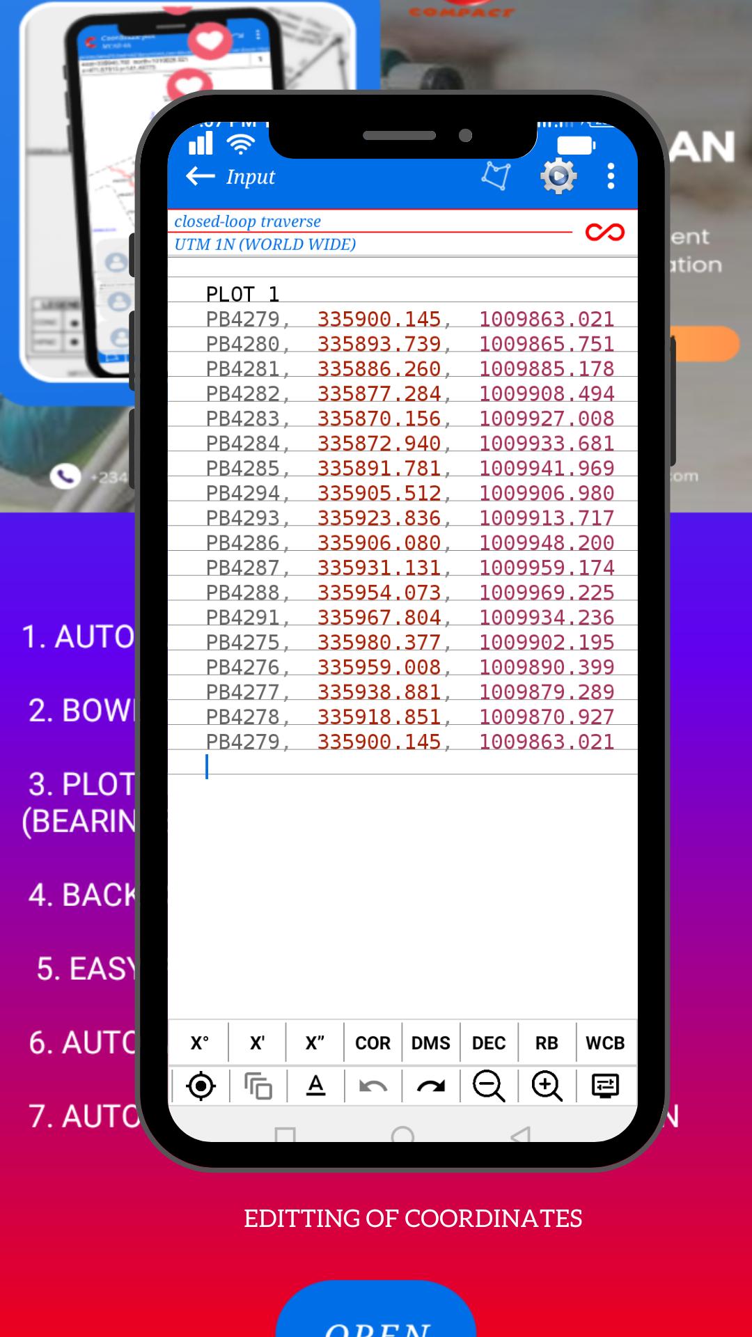
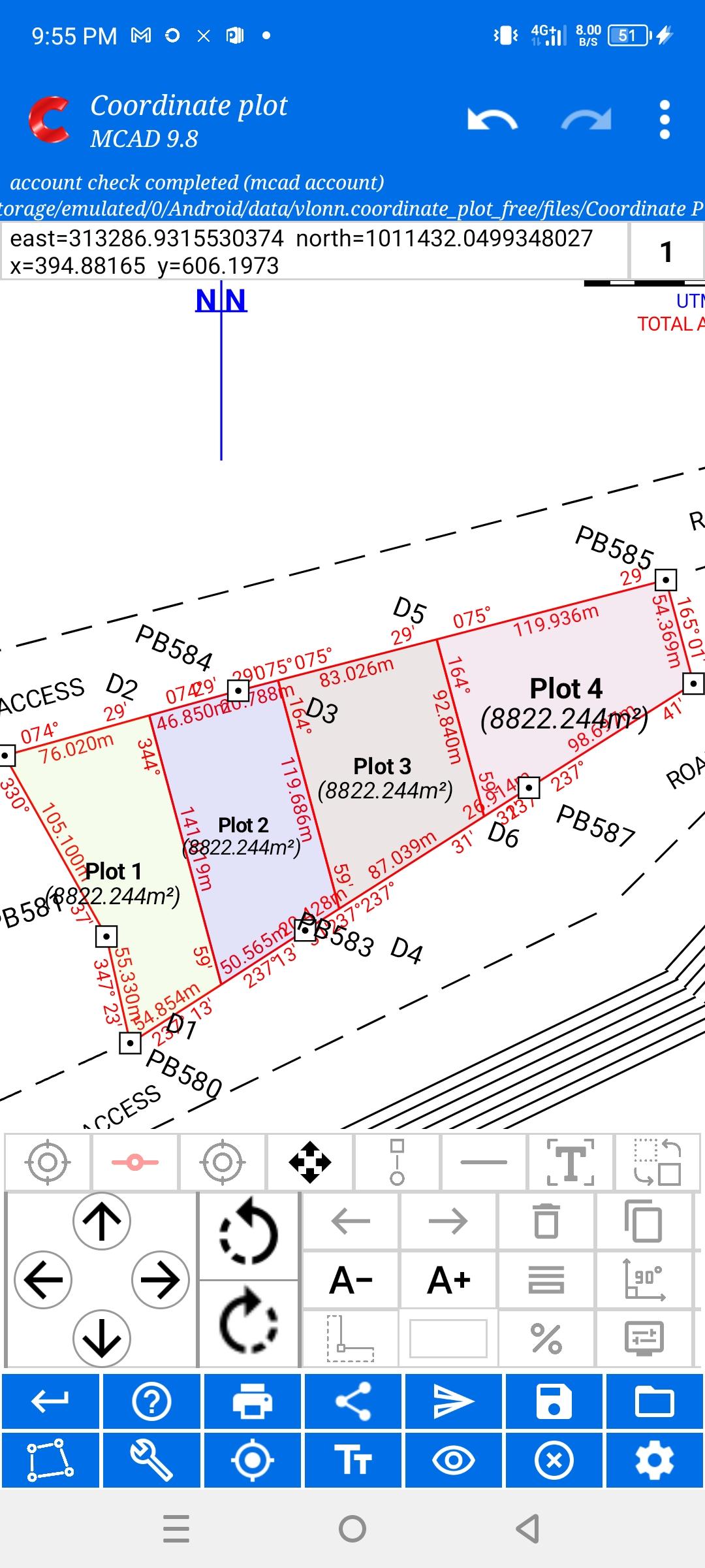
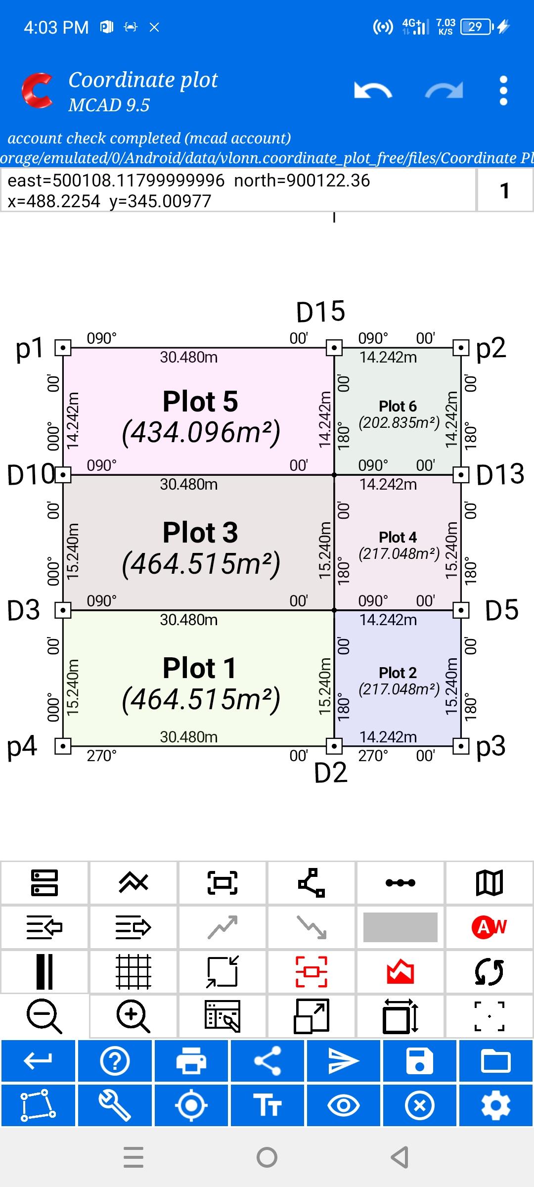
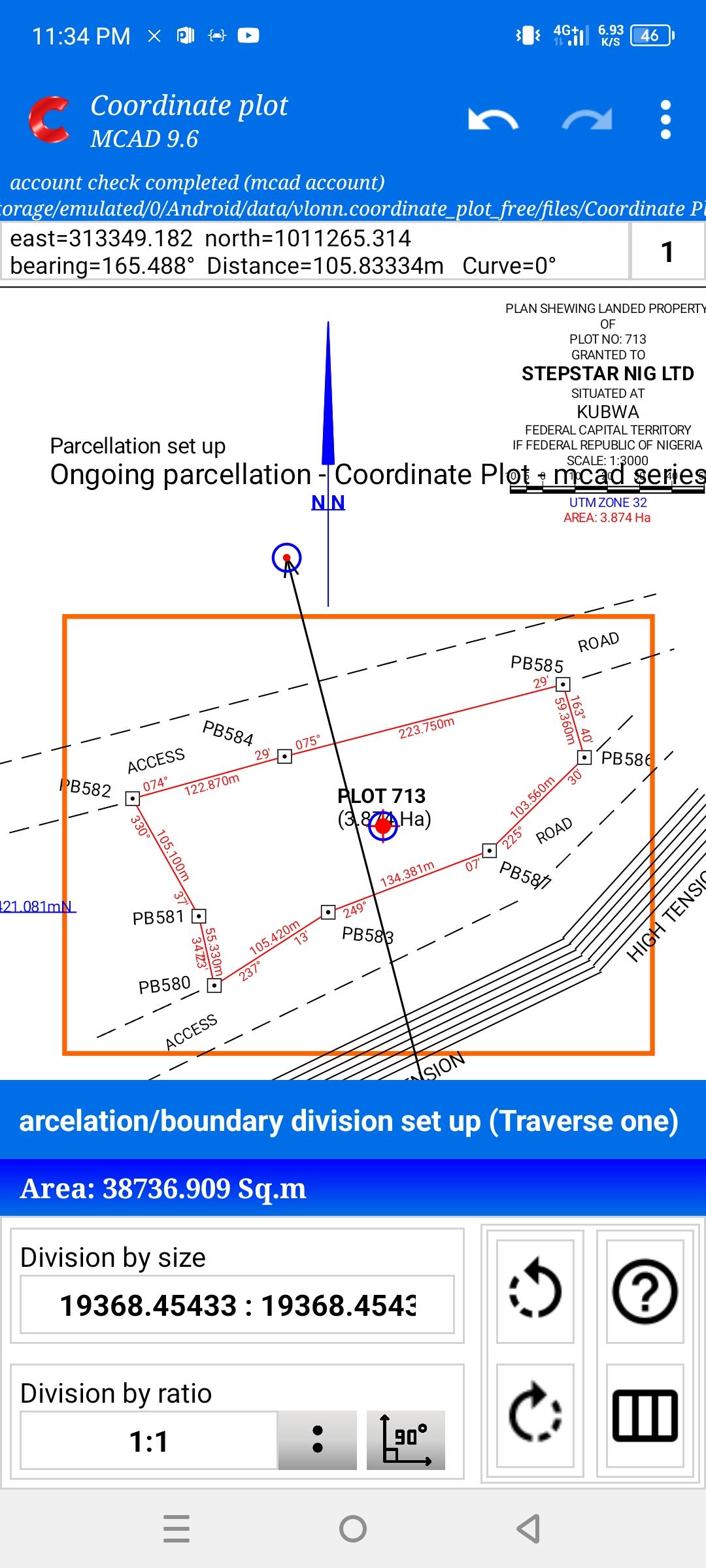
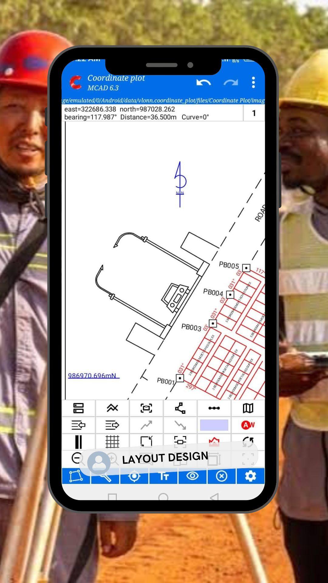
★ 根据测量员输入的现场坐标数据自动生成完整的专业测量图
★ 自动将土地分割成测量员定义的任意地块,并精确生成用于放样的坐标
★ 自动调整面积,同时保持原始边界形状
★ 反向计算坐标以进行验证和校正
★ 专业输出和导出:
以 PDF 格式打印测量图
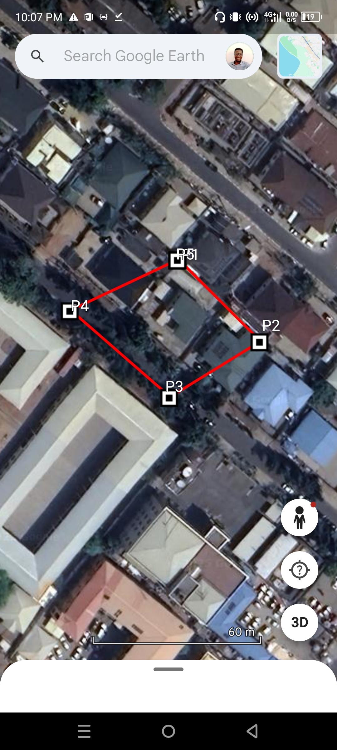
将数据导出为 KML 和 CSV 格式
AutoCAD (DXF/DWG) 导出 - 即将推出
所有输出均基于用户提供的测量数据,确保专业判断、控制和标准始终掌握在测量员手中。
Last updated on 2026年02月22日
Minor bug fixes and improvements. Install or update to the newest version to check it out!

Coordinate Plot
MCAD 18 by Ogbuji Stanley
2026年02月22日