Use APKPure App
Get 自転車ルート・標高グラフ・地形地図 | FieldTrip old version APK for Android
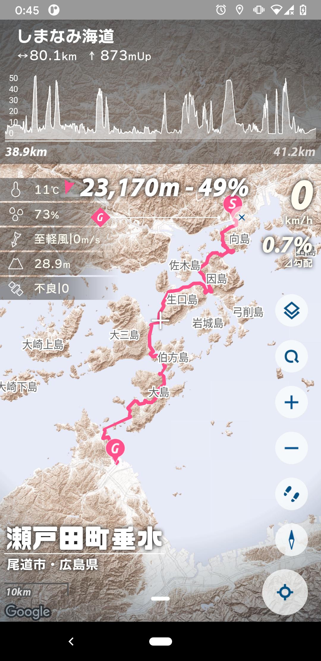
[For Yurupota] Speedometer, route creation, and simple navigation functions are available. You can intuitively understand the relief of the land with raster geotiles.
It is mainly a utility tool for bicycles, and you can use functions such as speedometer, track recording, and route creation that allows you to check the altitude graph. You can intuitively see the height difference with the original terrain tile. A little exploratory feeling is produced even for casual movements.
o Main features
Unique terrain tiles that allow you to intuitively understand the terrain
Record route, altitude and speed as a GPS logger
Route creation, elevation graph display
Simple navigation that shows the distance and direction to the destination
Supports north up and heading up
Display of sun direction, sunset, and sunrise direction
Display of weather information such as temperature, wind speed, and wind direction
Includes sample routes of the National Cycle Route (Shimanami Kaido, Biwaichi, Tsukuba Kasumigaura Rinrin Road)
o Usage
Cycling, pottering, long rides, wheeling, mini velo, cross bikes, road bikes, bicycles, bicycle trips, scatter, walks, walks, trips, microtourism, speed meters, trackers, GPS loggers, historic sites, shrines and temples, cafe activities .. .. And so on
Since you can see the terrain and altitude, you will be more aware of disaster prevention.
o Precautions and disclaimers when using
It is very dangerous to use while driving or walking. Please use with caution.
The developer is not responsible for any damage caused to the user by using this application.
The app may not be able to be provided due to changes in the specifications of the API used.
The bike route display is in beta. The routes in the search results may contain roads that are not suitable for biking.
Regarding peripheral search, route search, and street view, we may ask for a limited number of times or support in the future.
o license
Geospatial Information Authority of Japan basic map information (approval number Hei 28 ambassador, No. 740)
Hyogo Prefecture_Whole area numerical topographic map_Portal (2010-2018)
Geospatial Information Authority of Japan elevation API
YOLP elevation API
Google Maps API
Mapbox API
MPAndroidChart
android-gpx-parser
Glide
Joda-Time
o Reference
Geospatial Information Authority of Japan "Geographical Survey Map (Standard Map)"
Japan Meteorological Agency website
Ko Nagasawa "Calculation of sunrise and sunset"
o Contact us
Last updated on Aug 17, 2025
対象APIレベルを更新しました
Latest Version
![]() 25.08.13.1
25.08.13.1
Uploaded by
Chien Le
Requires Android
Android 10.0+
Available on
![]()
Category
Report


Discover what you want easier, faster and safer.

自転車ルート・標高グラフ・地形地図 | FieldTrip
25.08.13.1 by norameika!
Aug 17, 2025